
USGS Earthquake Hazards Map
Official United States Geological Survey real-time seismic monitoring map displaying worldwide earthquakes, magnitudes, and fault lines.
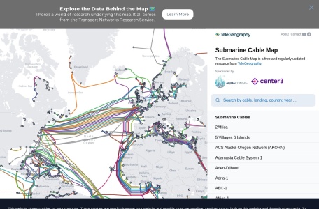
Interactive global map of the deep-sea fiber optic submarine telecommunications cables that carry 99% of global internet traffic.
Submarine Cable Map, created by TeleGeography, is a visual compendium of the physical infrastructure powering the global internet. Because over 99% of all international data traffic travels through undersea fiber-optic conduits rather than satellites, this interactive map provides an invaluable perspective on global connectivity, consortium ownership, and landing stations.
Yes. Undersea fiber cables transmit more than 99% of all transoceanic data; satellites account for less than 1% of global bandwidth.
The map depicts generalized cable routes for security and clarity; actual surveyed bathymetric cable routes are kept proprietary to protect infrastructure.
While historic cables were built by telecom consortia, hyperscale cloud providers (Google, Meta, Microsoft, Amazon) now finance or co-own a large percentage of new routes.